Hurricane Sally Moving Onshore Along Alabama Gulf Coast
(Updated 0445 am) Hurricane Sally made landfall near Gulf Shores Alabama at 4:45 this morning. Maximum sustained winds were reported to be 105 mph.
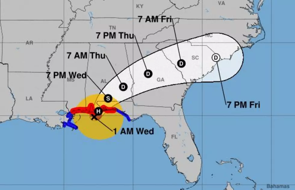
(Original Story) Hurricane Sally is continuing its snail's pace assault on the Alabama and Florida coasts this morning. As of the 0400CDT advisory from the National Hurricane Center, the storm was centered less than 50 miles south of Mobile. The storm was creeping to the north northeast at 3 mph.
The maximum sustained winds around the center of the storm were reported to be 105 miles per hour. Wind gusts of hurricane-force winds have already been reported in Mobile Alabama as well as from the Pensacola Naval Air Station.
While the winds near the storm's center of circulation are quite formidable, Sally will likely go down in history for its incredible rainfall. Areas along the Alabama and Florida Gulf Coasts have already received over a foot of rainfall in connection with the storm.
Those rainfall totals will only increase as the system slowly moves onshore and eventually away from the coast. It is estimated that portions of lower Alabama and western Florida could get another 15 to 20 inches of rainfall between now and this weekend.
The system should remain at or above hurricane strength through most of today. By tonight Sally is forecast to weaken to a tropical storm. The system should eventually move off the east coast of Georgia by late this week.
Elsewhere in the tropics of concern to South Louisiana is an area of disturbed weather in the southwestern Gulf of Mexico. Forecasters at the National Hurricane Center are giving that system a 40% probability of strengthening over the next five days.
Six Things A Cajun Needs To Survive A Storm
More From K945, The Hit Music Channel
![Orange Beach, Alabama After Hurricane Sally [HD-Video]](http://townsquare.media/site/33/files/2020/09/Orange-Beach-Hurricane-Sally.jpg?w=980&q=75)


