Hurricane Sally now Tracking Toward Alabama/Mississippi Line
When it comes to hurricanes what's good for one is usually bad for another. What I mean by that is this. Residents of southeastern Louisiana, including the city of New Orleans, are likely breathing a bit easier this morning as the forecast track for Hurricane Sally has now shifted eastward away from Louisiana.
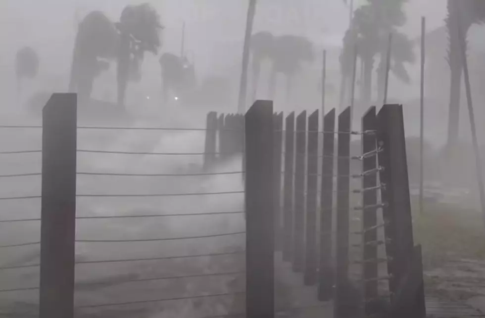
Meanwhile, residents of coastal Mississippi and Alabama are now bracing for what will likely be a direct impact from the system on Wednesday. However, the impacts of Hurricane Sally won't just be confined to the area around and near the center of circulation.
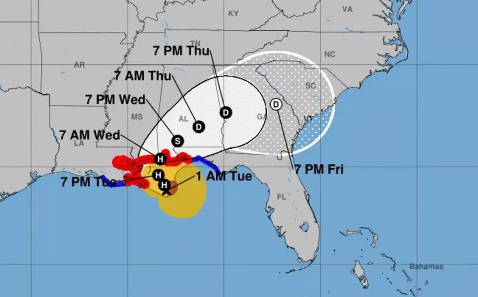
As of the 0400 CDT advisory from the National Hurricane Center, Sally was located a little over 100 miles south of Biloxi Mississippi. The storm had weakened slightly in the overnight hours and made a bit of a jog to the west in comparison to the National Hurricane Center track forecast. The system is creeping slowly to the west-northwest at 2 mph.
The slow-motion of the storm and it's proximity to land will likely mean a significant flooding event for portions of southern Mississippi, Alabama, and northwest Florida. Rainfall forecasts put the total amount of rain to be dumped on those areas during the course of the storm at 15 to 20 inches and higher.

The most recent track forecast from the Hurricane Center does suggest landfall will happen sometime on Wednesday within a few miles of the border between Mississippi and Alabama. Should that be the case the storm's strongest winds and highest storm surge would likely affect coastal Alabama, Mobile Bay, and the beaches of northwest Florida.
Elsewhere in the tropics, there are three other named systems that are being monitored and three other tropical waves that have the potential to develop into tropical cyclones over the next five days.
Fun Louisiana Destinations That Are Often Overlooked
More From K945, The Hit Music Channel
![Orange Beach, Alabama After Hurricane Sally [HD-Video]](http://townsquare.media/site/33/files/2020/09/Orange-Beach-Hurricane-Sally.jpg?w=980&q=75)