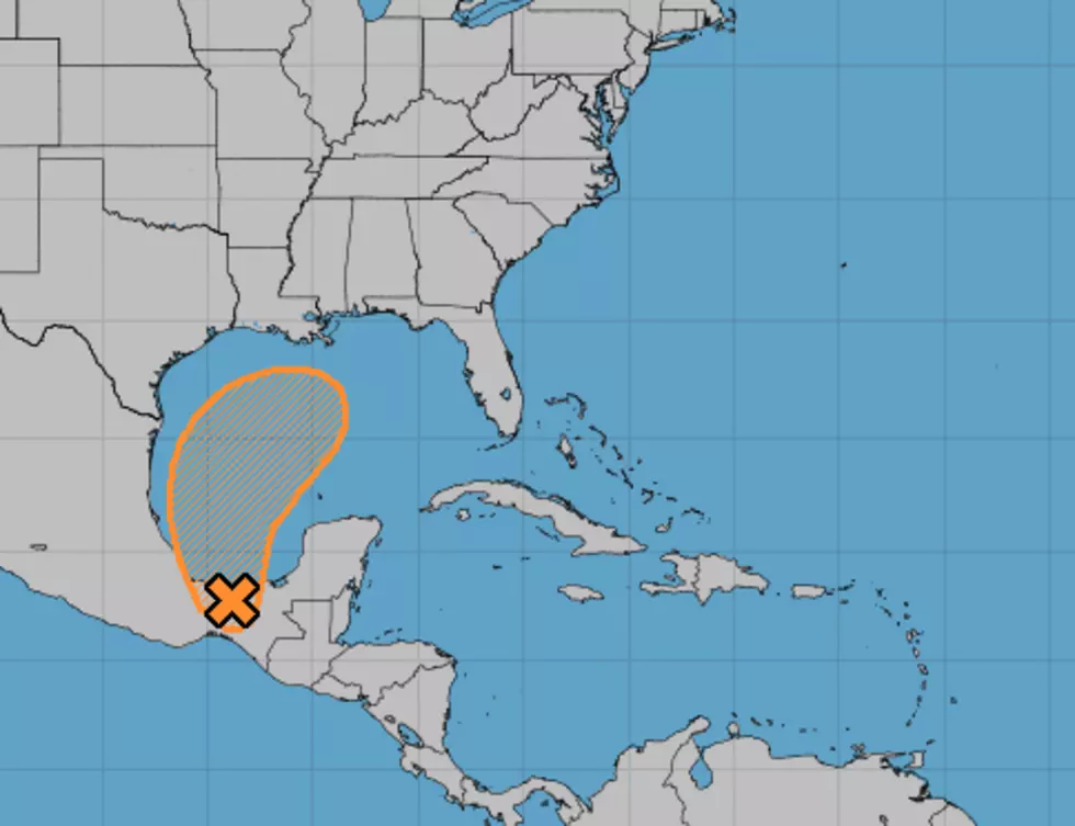
Tropical Threat in Gulf a Little More Likely
An area of disturbed weather is forecast to move out into the Bay of Campeche early this morning. This position would put the center of the highly disorganized storm system over some very warm water. Forecasters with the National Hurricane Center are suggesting that this warm water might be just the fuel the system needs to become a tropical cyclone.
As of early this morning, the Hurricane Center forecast only gives this area of disturbed weather a 40% probability of becoming a tropical cyclone over the next five days. The forecast track of the system could be problematic for the northern Gulf coast. That includes Louisiana's coastline.
Forecasters believe the system could become organized enough to be a prodigious rainmaker. Exactly where the system tracks will determine just what part of the world gets most of the rainfall.
Looking at the extended forecasts for later this weekend and early next week it does appear as if most forecast models are indicating increased rain chances. Again, if the most rain stays offshore then no harm, no foul. However, we've seen unnamed systems dump copious amounts of rainfall on coastal areas before. That's why we are tracking this system so closely.
More From K945, The Hit Music Channel