Hurricane Dorian Set To Impact Florida And The Gulf Of Mexico
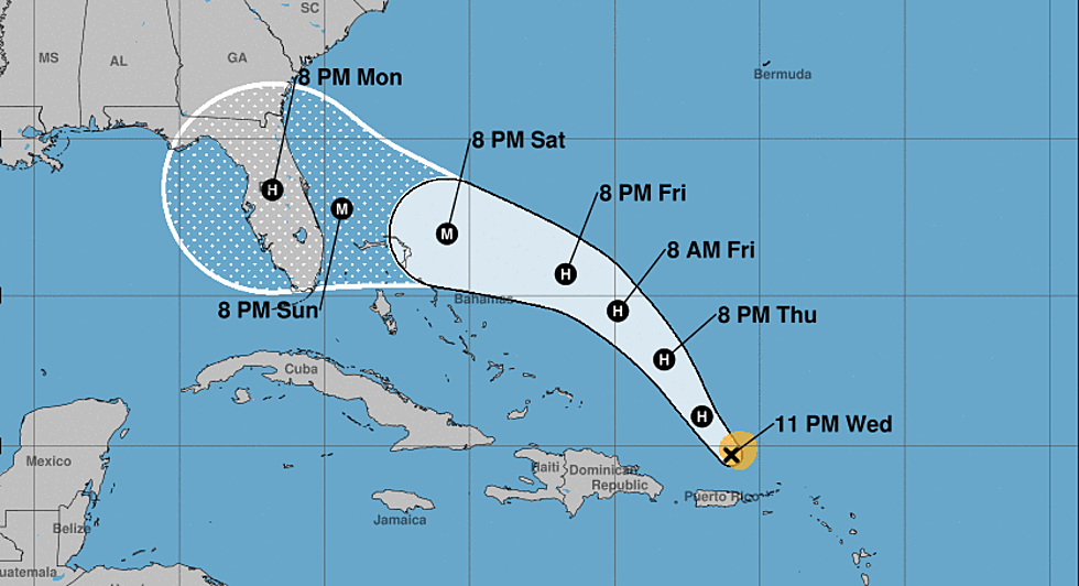
Forecasters with the National Hurricane Center have been tracking what has become Hurricane Dorian for about a week now. The system was first noticed as a tropical wave in the Atlantic Ocean and has since grown into a significant hurricane threat. In fact, that threat could be amplified by the time the storm makes a projected landfall on the Florida coast sometime Monday.
Yesterday, Dorian swept past the U.S. Virgin Islands and Puerto Rico as a strong tropical storm. It has since been upgraded to a hurricane and forecasters believe by Saturday the storm will be classified as a major hurricane.
The current forecast track from the Hurricane Center brings the storm onshore Labor Day between Fort Lauderdale and Daytona Beach. From there many of the tropical forecast models project the system will slide across the peninsula and into the Gulf of Mexico.
However, most of the model guidance does suggest a turn back to the north with a second landfall possible along the Florida Gulf Coast between Tampa Bay and Panama City. As of now, the storm appears to be no direct threat to the Louisiana coastline.
Remember model guidance is just an educated guess so use that information for planning purposes but rely only on official forecasts to make decisions about life and property. We will continue to monitor the progress of the storm through the Labor Day Holiday weekend.
More From K945, The Hit Music Channel


